Sense+
Sense+ uses advanced AI models to process UAV imagery, satellite imagery and geospatial data, to accurately identify and tag every unique tree. Sense+ module offers an effective, low cost method to maintain an up-to-date accurate inventory and evaluate land utilization.
Case Study: >98% Accuracy in Palm Tree Detection
Before Processing

After Processing
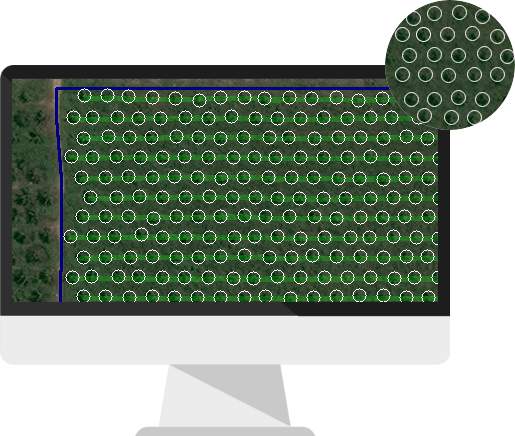
Tree
Planting Lines
Tree Detection Accuracy
>98%
Using Sense+ AI
Tree Detection Accuracy
100%
Using Sense+ AI & Vulcan Correction